Hey there! If you're involved in geospatial surveying, you probably know how important it is to pick the right GNSS Rtk Equipment. With technology advancing so fast and the demand for super accurate positioninggrowing, making the right choice can really make or break your project. I’ve been reading some recent industry reports, and it looks like the Global Gnss market is set to expand a lot soon. It’s an exciting time! Here atShanghai Apekstool (or APEKS), we’re all about providing reliable, innovative surveying and mapping tools—including GNSS/GPS systems, total stations, levels, theodolites, and all the accessories you need. In this blog, I’ll walk you through the key factors you should think about when selecting your GNSS RTK gear, so you can make smarter decisions and get better results on your projects.
Factors to Consider When Selecting GNSS RTK Surveying Equipment
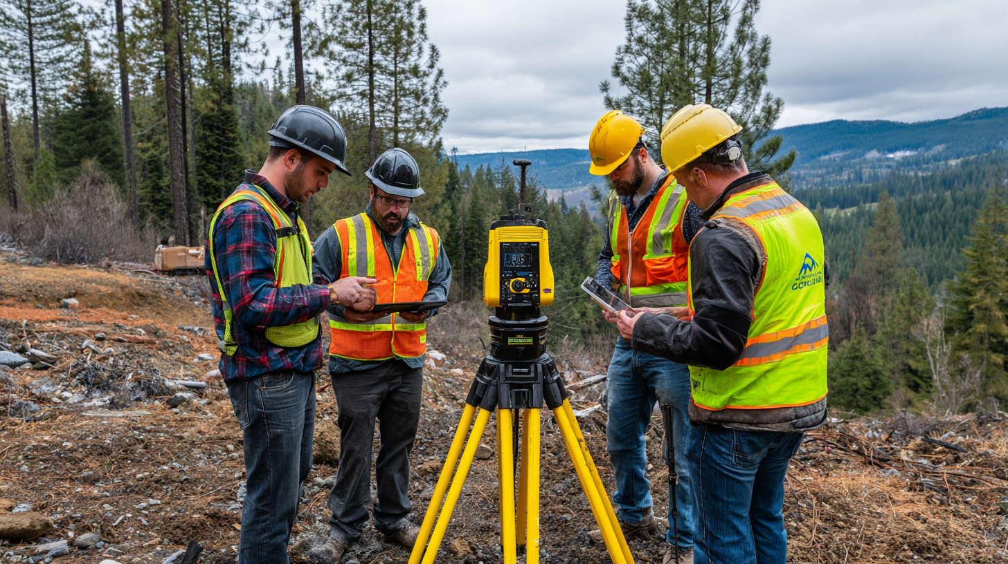
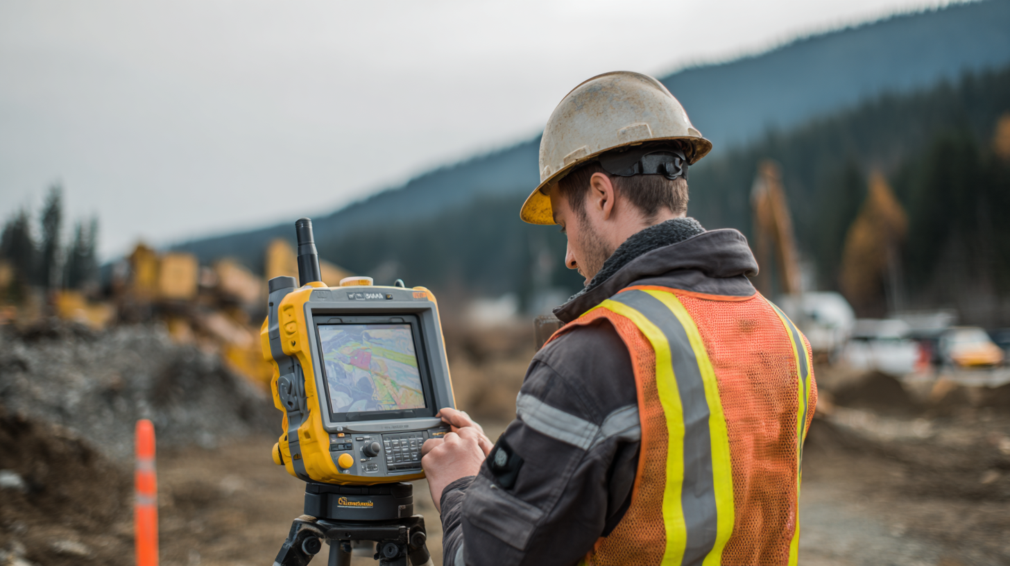
When you're choosing GNSS Rtk Surveying gear for your projects, there are quite a few things you really wanna think about — you know, to get the right balance between accuracy and your budget. First off, consider how precise you need the measurements to be. The International GNSS Service says RTK systems can get you to centimeter-level accuracy, which is super important for detailed work like construction, mapping, or building infrastructure. Also, think about where you'll be using the equipment. For example, in city environments, you might want to go for models that have advanced multipath mitigation, since signals bouncing around buildings can really mess with your readings.
Tip: Always check if your GNSS gear plays nicely with your current software and data systems. It makes life so much easier if everything can talk to each other smoothly — saves you a lot of hassle and time.
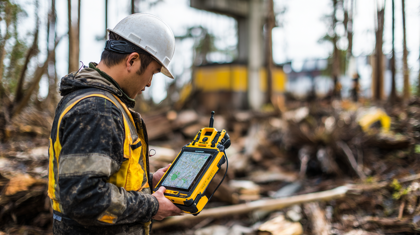
Another thing you shouldn’t overlook is how tough and weather-resistant the equipment is. Fieldwork can be pretty unpredictable — rough terrain, bad weather, you name it. The American Society of Civil Engineers points out that equipment failure because of tough conditions happens more often than you'd hope, and that can really slow your project down. So, it’s worth investing in something sturdy, built to withstand outdoor challenges, for better reliability and smoother operations.
Tip: Don't forget to look into the warranties and support options from the manufacturers. Having good support on hand can make a huge difference — quick help when something goes wrong means less downtime and less stress.
Understanding Different GNSS RTK Systems and Their Applications
When you're trying to pick out the best GNSS RTK surveying equipment for your projects, it’s really important to understand the different systems out there and what they’re best for. Not all systems are created equal — some offer higher accuracy, better range, or are more compatible with certain hardware. So, it’s a good idea to match the right tech to your specific needs. For example, some systems work better in crowded cities where signals might get blocked, while others shine in open, outdoor areas.
Here's a little tip: before you go ahead and buy something, take a moment to evaluate the kind of conditions you'll mostly be working in. Do some research on different GNSS RTK options, checking their specs to see which ones perform best for your kind of project. Think about things like how many satellites you’ll need to stay connected smoothly, and whether your work needs real-time data or if post-processing works just fine.
Also, don’t forget to consider how easily the new system will play nice with the gear you already use — like total stations or drones. It’s so much smoother if your new equipment can integrate seamlessly with your existing tools, saving you time and headaches.
A quick tip: go for user-friendly systems that come with good support and training. If a setup is easy to learn and operate, it’ll help you and your team get up to speed faster and avoid unnecessary frustrations.
Evaluating the Accuracy and Precision Needs of Your Surveying Projects
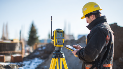
 So, when you're picking out GNSS RTK surveying gear, it’s pretty important to really get a feel for what kind of accuracy and precision your project actually needs. The NOAA actually points out that these systems can often give you horizontal accuracy within just a few centimeters—if conditions are just right. That kind of precision isn't just nice to have; it’s often a must, especially for engineering and construction jobs where even tiny errors can lead to serious cost issues. So, taking a good look at the environment and operational conditions where you'll be doing your surveying is definitely worth it to make sure your equipment can handle the job.
Tip: Think about where you'll be working. Places like urban areas with tall buildings? They can cause multipath errors that mess with your accuracy. So, it's smart to go for gear that uses advanced filtering and algorithms designed to cut down on those kinds of issues.
Also, keep in mind that the level of precision you need can vary a lot depending on what you’re surveying. For example, topographic surveys often need about 2 to 5 centimeters of accuracy, but boundary surveys might need to be within 1 centimeter. A 2020 market analysis from Research and Markets even found that high-end RTK systems can get you below a centimeter accuracy—definitely worth considering if your project demands really high precision.
Tip: Don’t forget to think about the future—can your GNSS RTK system grow with your needs? Picking a flexible, adaptable system now means you won’t have to replace everything down the line if your project scope changes or scales up.
Budgeting for GNSS RTK Equipment: Costs vs. Benefits
So, when you're starting out with a GNSS RTK surveying project, one of the things you really can’t overlook is budgeting wisely. Getting your hands on top-notch GNSS RTK gear can cost a pretty penny—anywhere from a few thousand dollars to even tens of thousands, depending on the specs and what you need it to do. For example, a report from the Geospatial Equipment Market mentions that most professional-grade systems usually hover around $10,000, but that number can go up or down based on features like connectivity options, accuracy levels, and software compatibility. It’s super important to weigh these costs against the kind of benefits you’ll get—because, honestly, a solid system can make a huge difference in how smoothly your project runs and how much long-term value you get out of it.
Here at Shanghai Apekstool (APEKS), we totally get that having the right equipment can seriously boost both your survey’s accuracy and your overall productivity. Investing in the latest GNSS tech might seem pricey upfront, but it can actually save you time and deliver more precise data, which pays off in the end. In fact, industry folks estimate that using the newest GNSS solutions can bump up your operational efficiency by about 30%. That’s a pretty compelling reason to set aside the budget. By focusing on reliable geospatial gear, you're not just meeting your current project needs—you’re also setting yourself up to stay ahead as the industry keeps evolving. It’s all about future-proofing your work and making sure you're ready for whatever comes next.
Key Features to Look for in GNSS RTK Surveying Devices
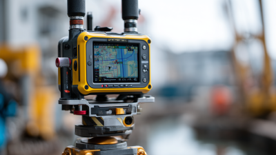
When you're choosing GNSS RTK surveying gear, there are a few key features you definitely want to keep an eye on to make sure your work is accurate and smooth sailing. For starters, positioning accuracy is a big deal — most top-notch systems aim for a steady 1-2 cm precision. Thanks to the latest tech in RTK, surveyors can now pull off such precision over pretty large areas, which really helps streamline workflows and makes data more reliable.
Another thing to consider is how well the equipment plays with software tools. The recent updates really emphasize the importance of compatibility with different platforms — it can solve a lot of headaches and boost what your gear can do. For example, tackling PPK issues during post-processing of kinematic data can make managing and analyzing your data way easier.
Pro tip: Don’t forget to check your GNSS network coverage and make sure your device can do cloud-based RTK — those services are getting more reliable and accessible these days. Also, think about the weight and battery life; a lighter device can make things a lot easier to handle without sacrificing performance. Focusing on these features will set you up for success, especially with how demanding precision surveying is getting these days.
Comparing Leading GNSS RTK Surveying Brands and Models
So, when you're trying to pick out the best GNSS RTK surveying gear for your projects, it's pretty important to take a good look at the top brands out there right now. Big names like Leica Geosystems, Trimble, and Topcon each have their own strengths and features, so it kinda depends on what you need. Leica, for instance, is known for its super accurate and reliable systems—great for those tough environments where precision really matters. On the flip side, Trimble is often praised for how user-friendly their equipment is and how smoothly it plays with software—perfect if you're all about efficiency and hassle-free data management. Then there's Topcon, which really shines with its advanced connectivity options and rugged design; they’re built for folks working out in the field, come rain or shine. Oh, and don’t forget to weigh things like battery life, how portable the gear is, and what kind of support you can expect—those little details can really tip the scales. Bottom line? understanding exactly what your project needs will help you pick the right equipment, so you get tools that boost both your productivity and accuracy in the field. Trust me, taking the time to compare these options really pays off in the end!
How to Choose the Best Gnss Rtk Surveying Equipment for Your Projects
| Model | Accuracy (cm) | Rover Range (km) | Battery Life (hrs) | Weight (kg) | Price ($) |
| Model A | 2 | 10 | 8 | 0.9 | 3,500 |
| Model B | 1.5 | 12 | 10 | 1.2 | 4,000 |
| Model C | 1 | 15 | 12 | 1.0 | 3,200 |
| Model D | 2.5 | 8 | 7 | 1.1 | 4,500 |
| Model E | 0.5 | 20 | 15 | 0.8 | 2,800 |
Revolutionizing Precision: The AP30 Laser Dual-Cameras RTK GNSS Receiver with Advanced Technologies
In the realm of geospatial technology, the AP30 Laser Dual-Cameras RTK GNSS Receiver stands at the cutting edge of precision and efficiency. This high-end GNSS receiver incorporates advanced technologies, including the latest Global Navigation Satellite System (GNSS) capabilities, a Super Inertial Measurement Unit (IMU), and millimeter-level green laser technologies. Such innovations are essential as the industry aims to improve positional accuracy, with recent reports indicating that geospatial data accuracy can significantly influence strategic decision-making processes in areas such as engineering and construction.
The combination of dual cameras and sophisticated laser measurement not only enhances the operational scope of the AP30 but also provides unprecedented levels of detail that meet the growing demand for precision in various applications. According to a 2022 market analysis, the global GNSS market is projected to grow at a CAGR of 8.5%, highlighting the increasing reliance on high-accuracy navigation and surveying tools. The AP30 fulfills this demand by offering real-time data processing and an accuracy level that can achieve centimeter-level precision, enabling professionals to execute their projects with confidence.
As the technology landscape evolves, the AP30 Laser Dual-Cameras RTK GNSS Receiver represents a significant leap in measurement and positioning. Its innovative integration of advanced GNSS capabilities and cutting-edge laser technology ensures that users are well-equipped to tackle the complex demands of modern surveying and mapping tasks, aligning perfectly with the industry's trajectory towards automation and enhanced reliability.
FAQS
: The primary consideration is the precision level needed, as RTK systems can achieve centimeter-level accuracy, essential for detailed surveying tasks.
The environment can impact the choice of equipment; for example, urban settings may require models with advanced multipath mitigation technology to reduce measurement errors due to signal interference from buildings.
Equipment durability is crucial because field conditions vary widely, and harsh weather or rugged terrain can lead to equipment failure, delaying projects.
It is important to review product warranties and support services provided by manufacturers to decrease downtime and ensure rapid troubleshooting when issues arise.
Continuous 1-2 cm positioning accuracy is considered a benchmark for high-performance GNSS RTK systems.
Compatibility with advanced software tools can resolve common issues and enhance functionality, improving data management and analysis processes in surveying projects.
Cloud-based RTK services are increasingly reliable and accessible, making it essential to ensure the equipment supports such services for better performance.
It is important to compare precision, user interface, integration capabilities, battery life, ease of transport, and support services when evaluating different brands.
A lighter device can improve maneuverability without sacrificing performance, making it easier to use in various surveying conditions.
Each brand offers unique features catering to different surveying needs—Leica is known for precision, Trimble for user-friendliness, and Topcon for advanced connectivity and robust design.
Conclusion
Picking out the best GNSS RTK surveying gear for your projects isn’t always straightforward. There are quite a few things to keep in mind. Getting to know the different GNSS RTK systems and understanding what they’re best suited for can really help you pick what’s right for your specific surveying needs. It’s also super important to think about how accurate and precise you need your measurements to be. Budget-wise, you’ll want to weigh the costs against the benefits — after all, you don’t want to overspend on something that’s more than you need, but at the same time, you want reliable tools. Don't forget to look out for the features that guarantee dependability and good performance. And hey, taking some time to compare top brands and models can really point you in the right direction when it comes to choosing your gear. At Shanghai Apekstool (APEKS), we get how complex geospatial surveying and mapping can be. That’s why we offer a wide range of innovative GNSS RTK equipment and other survey solutions, all designed to meet the ever-changing needs of professionals like you. Our goal? To make sure you’ve got the best tools so you can get the job done right and achieve great results every time.